

We’ve spent the last week in Northern Norway, covering less distances and enjoying the slower pace of life in this remote part of Europe. The weather has been cold for this time of year, with the average daily temperature around 10 degrees, but we have had sunshine on and off, enough to enjoy being outdoors in this beautiful part of the world.
The ferry from Bodo to the Island of Moskenes in the archipelago of Lofoten takes around 3 hours, crossing the Vestfjord in the Norwegian Sea. The ferry cost us $380 NZD with the campervan. Our van measures 7.45metres, if you have a van under 7 metres you do save a bit on ferry crossings. We knew this before we bought our van, but weren’t willing to compromise on space.
The Norwegian Sea is known to be wild and we told to be wary if you get seasick. We were lucky, the sea was like a millpond, beautifully calm. Our first view of Lofoten was of dark jagged mountains rising from the sea, still capped with snow. As we drew closer this dramatic landscape began to take shape, with bright green vegetation contrasting against the slate grey cliffs, and the vivid turquoise water lapping onto stony beaches.

We arrived and drove around the bay to the small fishing village of Å, where we planned to spend the night. It was barely a camping ground, more like a parking lot on a rocky outcrop. With limited space and a whole lot of campers just off the ferry and all looking for somewhere to stay, it made for an interesting hour. The host, in good Norwegian spirit, was not fazed and found space in places you’d never think a camper could fit. The electricity connection looked like something from the third world, cords in all directions, but the shower was the best we’d had so far with amazing pressure and a view over the ocean to boot.

Å is a traditional fishing village specialising in stockfish – fish dried on wooden racks in the cold winter air so it ferments, similar to a cheese, and therefore has a shelf life of years. Stockfish has been a major export commodity for Norway over many centuries and is used in traditional dishes across the world, including in Italy and Nigeria. There were still some heads of fish drying on the racks when were there, but the majority is done in the colder months. We were told the smell is quite overpowering for the first week, and washing hung out during that time absorbs it all, making for interesting looks if you leave the islands.

Tourism is now a major part of the economy of Lofoten and Å has embraced this, with accommodation built in old fishing huts over the water to cater for tourists keen to try their hand at catching some of abundant fish life in the area.

Fishing isn’t for us so we made the most of the natural environment and walked around a nearby lake and up a ridge to overlook the bay, after which we treated ourselves to a pint at the pub on the pier. At $16 a pint it was a treat!

The next morning, we headed off around the windy coastal roads to the next island in Lofoten, Flakstad. We stopped in Nusfjord one of Norway’s oldest and best-preserved fishing villages. It’s now a museum and we spent an hour or so wandering through the village. Life as a fisherman would not have been an easy one in years gone by, although it’s still tough nowadays battling the elements in this part of the world. While we were watching the gulls tending their nests on the walls of the village buildings and discussing how different this was to NZ gulls, a boat arrived with the sole occupant dressed in all-weather gear. Andrew was quick to stop him and ask some questions we had about the fish drying process. He was more than obliging to tell us all he knew, as he was the son a fisherman and had grown up in the area spending many hours cutting the tongues out of cod, a local delicacy. He now lives in Berlin with his English wife and is a glass artist. He was back in his hometown to sell some of his artworks at the summer markets on the islands, and was happy to spend time giving us insight into growing up in Nusfjord, even inviting us to visit him in Berlin.
We carried on around the coast along fjords and over mountain ranges to the small settlement of Hov. Hov is one of the oldest places in Lofoten and has historical significance with traces of Viking settlements. It also faces the sea in the North, making it an ideal place to see the so far elusive midnight sun. It was raining when we arrived so we didn’t hold out too much hope.

After visiting the Icelandic ponies in the horse trekking stables next to the campsite we walked along the beach and then up to a what looked like a new subdivision of houses. All the homes were built to be in keeping with the environment, coloured and landscaped to match the natural wildlands surrounding them. We have been intrigued about the grass roofs that we’d seen in many mountain villages in Norway, and which some of these houses had. Fortunately, one of the home owners with a grass roof was outside, so we stopped to ask him about it. He was a great find. This was his holiday home and he had just built a new garage which was yet to have the grass roof added, allowing him to show us what the base was like and how it all worked. There’s no real benefit to grass roofing other than aesthetics. It’s a Norwegian tradition and makes your house look more part of the environment, in fact it sounds like it is a lot higher maintenance than your average roof, requiring fertiliser and trimming, and repair work after any major storm. He told us the subdivision was all holiday homes, and most occupants were business people from Oslo who escape to this remote island in weekends. The well-known Lofoten links golf course nearby is an added benefit. Being from an island further north he encouraged us to change our planned route to Tromso, and instead take the less travelled route via the Vesteralen islands, to experience their stunning natural beauty and remoteness. We took his advice.
On the same evening walk we passed a barn with a sulky leaning against it. I’d seen what looked like a small harness racing track in a town we passed through earlier that day and we were curious to see what sort of horses they were racing. The couple in the barn were more than happy to talk and to show us their small racing operation – four horses in the barn, of which only one was currently racing. These are Norwegian Trotters, a type of small draft horse bred for harness racing, complete with the trademark feathers of heavy horse breeds. It’s apparently quite a popular sport in Scandinavia, even in winter when the horses wear studded ice shoes, and our new friends were keen to show us their array of trophies and newspaper clippings telling of their success.

Back at camp that night, the clouds cleared enough for us to witness the sun peeking through just on midnight. We ran down the beach excitedly taking photos and relishing the moment. Andrew FaceTimed his mother to let her experience it as well. We have now seen the sun shining in the sky at midnight – success.


Our late night didn’t deter us from an early morning hike up Hoven mountain, a 368 metre craggy rock rising out of swampland behind the campsite. A third of the way up Andrew decided the warm sun on the mountainside was too alluring and lay down in the heather to await my return. I carried on to the top and the views were definitely worth the effort, although Andrew thought he had the better deal relaxing in the warmth, watching the golfers below, and chatting to passing hikers heading up the hill.


Next, we headed towards the archipelago of Vesteralen, enjoying more stunning scenery and eventually arriving at the township of Andenes on the Island of Andoya. Andenes once was a major military base for Norway, but because of Norway’s current stance on defence, the military base mostly been removed. The locals are fighting to keep the remaining air force base open as it employs many in the town – it doesn’t sound promising. The rows of uniform houses, that look like they were made from shipping containers, are a constant reminder of the military past. Tourism is now more important than ever, with whale watching and tours to the puffin colony popular attractions in the area. However, the town is desolate and windblown and is not a place you’d linger in. We were there as a stopover before catching the ferry the next day to the island of Senja. Another ferry crossing, this time $302 NZD for the hour and a half trip – the terrain in Norway does not make for cheap or quick travel.

Senja is gorgeous. We were told it is like the whole of Norway packed into one small island, and it was. Fjords, lakes, mountains, forests, and that beautiful turquoise water in the bays that turns inky black as it reaches into the deeper sea.

We found a unique place to stay in Mefjordvaer, on a pier at an upmarket fishing resort where they offer parking for just two motorhomes. Mefjord Brygge is the sort of resort wealthy tourists fly into for the authentic fishing experience. They have numerous fishing boats and all the gear needed for hire, along with the expert advice from guides, and the well renowned restaurant with an impressive wine list provides the perfect finish to a day on the water. And of course, the setting is magnificent. We spoke to two elderly German gentleman who were heading out to fish at 7pm and came back two hours later with two very large cod and equally big smiles. It was a great spot and, as we have found all the way through Norway, the people were friendly and hospitable, nothing is too much trouble and you are always made to feel so very welcome.

We continued our tour of Senja, heading to the small island of Husoy, famous for their spicy smoked salmon. Located only about 100 metres offshore, and connected to the main island by a bridge, this island is just a dot, only 1km long and 500 metres wide, and amazingly home to 300 people. Like most settlements in this area fishing provides a livelihood and in Husoy there is a large a commercial fish factory prominently placed at the entrance of town. We bought some of the spicy smoked salmon we had heard about and ate it for lunch, on sourdough with cream cheese while waiting for the ferry to Kvaloy. Yes, another ferry – only 30 minutes this time, and $140 NZD.

From the ferry, we continued towards Tromso, and to my delight met a herd of Reindeer on the road. Screaming for Andrew to stop and scrambling for our camera I nearly caused a pile up if it wasn’t for cool calm collected Mr Love. By the time we’d safely pulled over they had moved off the road onto the grassy slopes. I jumped out of the van and took off after them to get my photos. It was only after coaxing them to look up for the camera by making clicking sounds that I noticed one, with particularly big antlers, had been staring at me for a while and was starting to move toward me in an assertive manner. Oh God, do Reindeer attack? Thankfully not these ones.

Reaching Tromso meant we had reached our northernmost destination in our Norwegian adventure. Known as the Paris of the North for its lively, colourful atmosphere and elegant beauty, it was a beautiful place to spend our last two days in Norway.
We visited the striking Arctic Cathedral, biked across the bridge to the city centre, and wandered through the streets and parks, enjoying some sunshine at last.


After three weeks in Norway we are off to Finland tomorrow. We’ve packed a lot into our time here, made much easier by the never-ending daylight, and we have fallen in love with this spectacular country, so much so we will definitely be back – perhaps in autumn or winter next time to experience the Northern Lights.
Senja, Norway
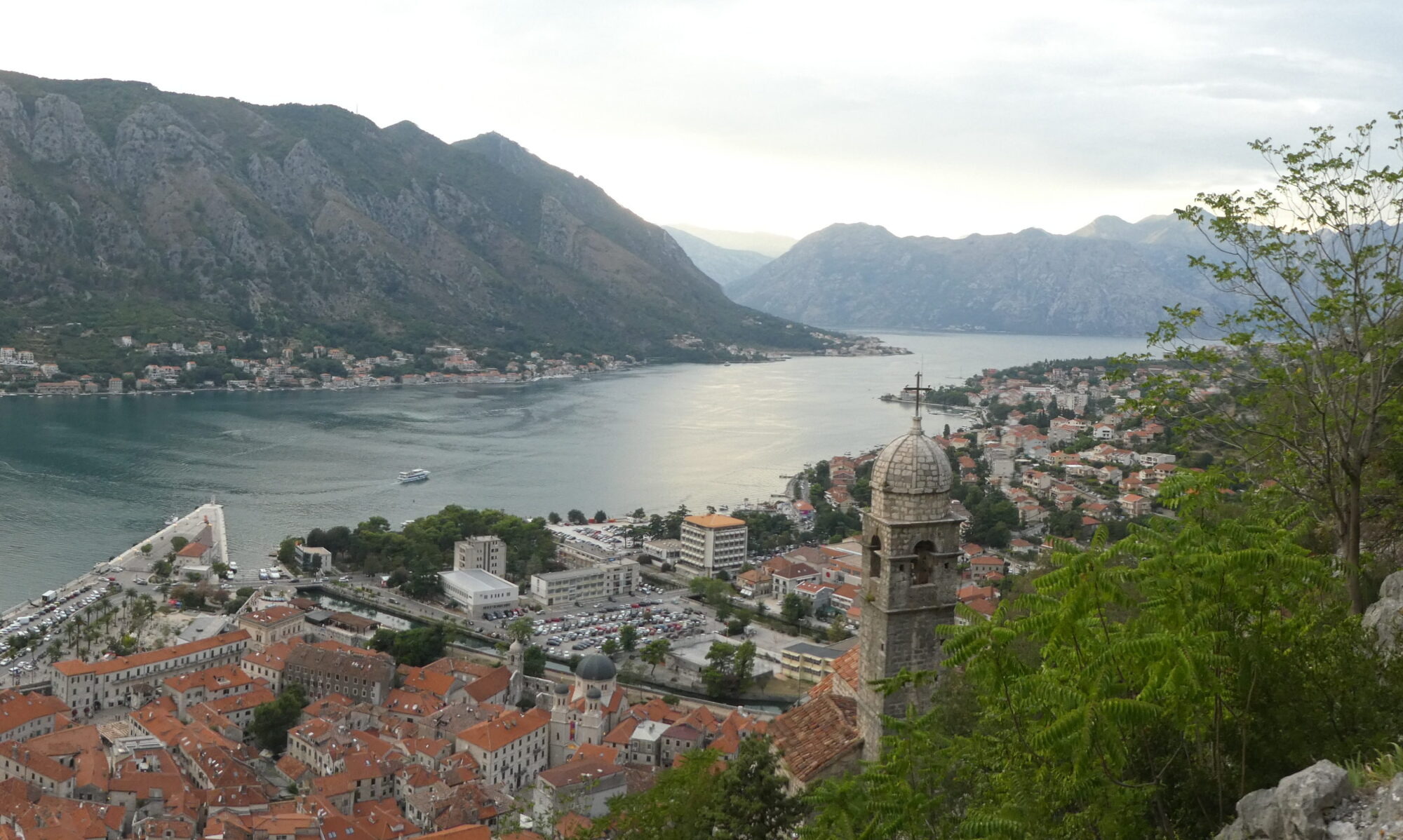
Lofoten, Norway


